![]()
Information
Submitted by Anonymous on Thu, 2010-09-09 13:57


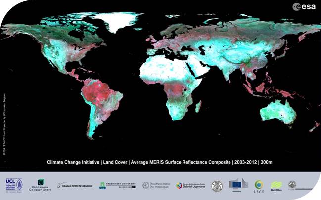
In the frame of the Climate Change Initiative (CCI) project, a "Land Cover" Essential Climate Variable was defined. Land Cover can be defined as the physical material at the surface of the earth. It include grass, asphalt, trees, bare ground, water, etc... The GCOS Implementation Plan states that* :
- Land cover influences climate by modifying water and energy exchanges with the atmosphere, and changes greenhouse gas and aerosol sources and sinks.
- Many climatically-relevant variables that are difficult to measure at global scale (e.g. surface roughness) can be inferred in part from vegetation and land-surface types. Thus land cover can be a surrogate for other important climate variables.
- Current climate models operate on resolutions of 0.5º to 1º, but land cover information at moderate resolution is needed to correctly describe the spatial heterogeneity of the land surface within the model cells.
In this context, the purpose of the Land_Cover_CCI project is to make the best use of available satellite sensor data in order to provide an accurate land cover classification that can serve the climate modeling community.
*GCOS, 2006, Systematic Observation Requirements for Satellite-based products for Climate – Supplemental Details to the GCOS Implementation Plan, GCOS 107, September 2006. Available online at www.wmo.int/pages/prog/gcos/index.php
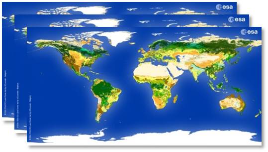
CCI Land Cover products