![]()
Prototype Land Cover map over Africa at 20m released
Submitted by abellavia on Tue, 2018-02-06 23:41In September 2017, a prototype high resolution Land Cover map over Africa was released. It has been developed at 20m, based on 1 year of Sentinel-2 A satellite observations from December 2015 to December 2016. The main objective to make public this prototype is to collect user’s feedback for further improvements. In this context, there has already been 1000 downloads and 17 000 views. Read more »
Recent CCI Land Cover Publications
Submitted by abellavia on Tue, 2018-02-06 23:24CCI Land Cover team publishes the overall work related to this project through peer-reviewed papers. Recent publications are available here below : Read more »
New video available : Changing Lands Animation
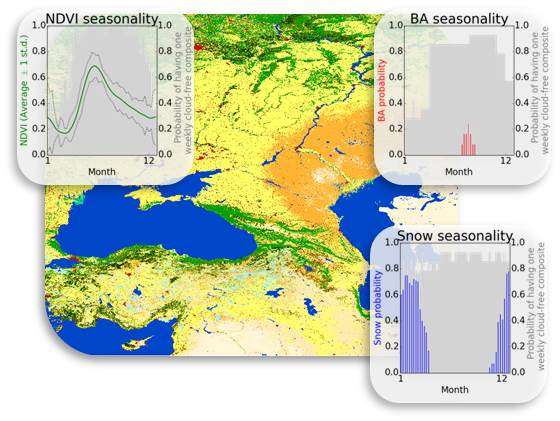
Submitted by abellavia on Mon, 2018-01-22 15:09Land cover maps describe the different types of materials on the Earth's surface, such as water bodies, ice cover, crops, forests, grasslands and artificial surfaces. This information is important for tracking changes in land use, conserving biodiversity, managing natural resources, and understanding climate change. Read more »
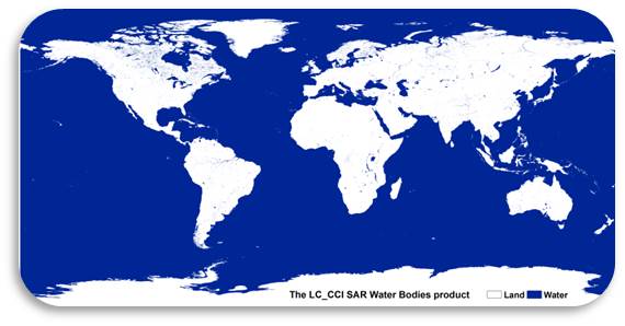
A new inland/ocean layer compatible with the CCI Water Bodies product v4.0
Submitted by clamarche on Thu, 2017-09-28 13:23The ESA Land Cover CCI project has now released an additional feature to the CCI Water Bodies v4.0: the distinction between inland water and ocean. More information on the methodology here.
The layer can be downloaded on the project viewer: http://maps.elie.ucl.ac.be/CCI/viewer/download.php
CCI Water Bodies v4.0 showcase
Submitted by clamarche on Thu, 2017-09-28 11:43The CCI Water Bodies v4.0, together with many outcomes of the ESA Climate Change Initiative, was showcased in an ESA - Planetary Visions animation describing the physical processes causing global sea-level rise.
The video is visible on the ESA space in video page.
1st CCI Land Cover User Workshop
Submitted by clamarche on Mon, 2017-09-25 14:46Venue: ESA-ESRIN - FRASCATI, ITALY
Date: 31st August 2017
The 1st CCI Land Cover workshop aimed at introducing the CCI Land Cover dataset in details and sharing experiences on its exploitation in various contexts from climate modelling to UN statistics. It was also an opportunity to exchange on the appropriate use of this long term time series and the expected support
Thank you to all presenters and participants who contributed to the success of this meeting !
Agenda
For those who could not attend the meeting but have an interest in the presentations, see the Workshop Agenda.
See also the zip with all presentations.
Broadcast
The recording of the meeting can be found here (8GB).
Products download
http://maps.elie.ucl.ac.be/CCI/viewer/index.php (top right red button)
(c) ESA Climate Change Initiative - Land Cover led by UCLouvain (2017)
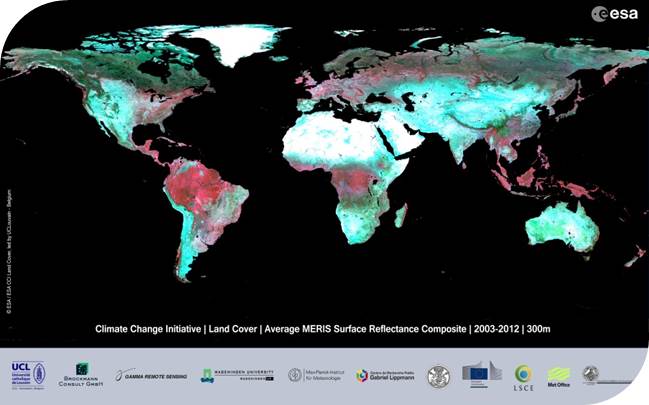
Annual global land cover mapping at 300m and characterisation for climate modelling
Submitted by abellavia on Wed, 2017-09-06 14:31
1st CCI Land Cover User Workshop | 31st August 2017 | ESRIN (Frascati, Italy)
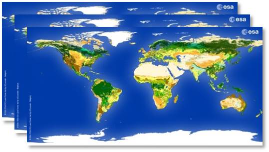
Submitted by abellavia on Fri, 2017-07-28 12:25300 m annual global land cover time series from 1992 to 2015
Submitted by abellavia on Mon, 2017-04-10 14:35CCI Land cover - 300 m annual global land cover time series from 1992 to 2015 - available now for download
Newsletter - Special Issue Living Planet Symposium
Submitted by abellavia on Tue, 2016-05-10 11:39The CCI_Land Cover team publish a special issue of the newsletter for the Living Planet Symposium.
More information about the second release of CCI Land Cover products are delivered.
This release offers : Read more »
CCI Land Cover products